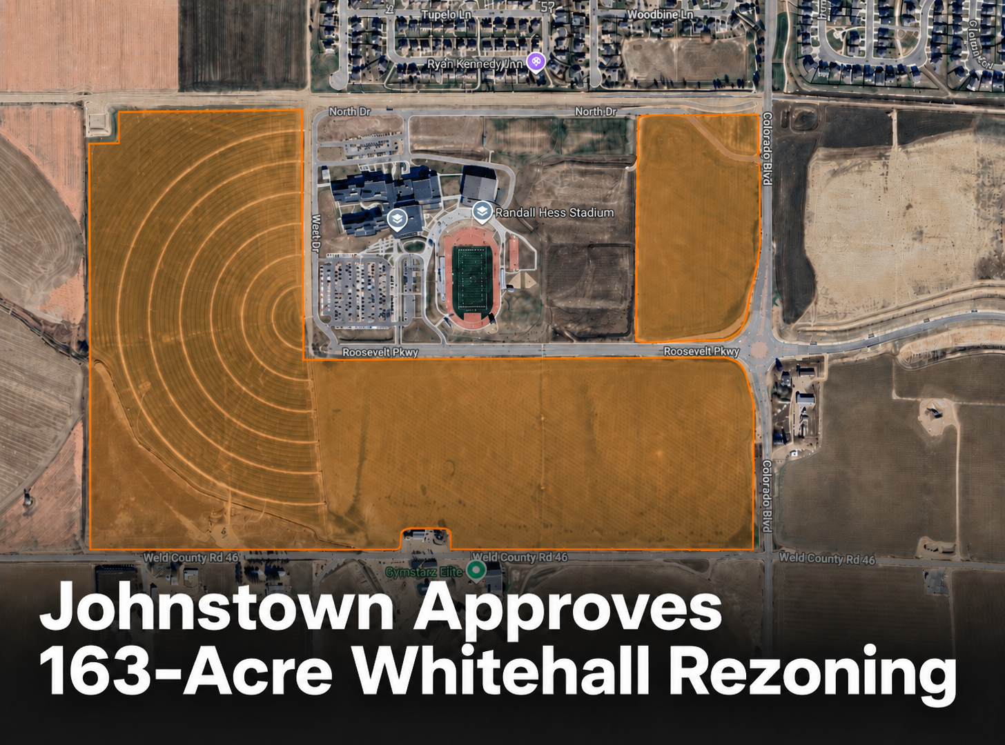
Johnstown’s Town Council has given final approval to new residential and commercial zoning for approximately 163 acres in Whitehall Filing No. 2.
Ordinance 2026-294 received second-reading approval Aug. 3 as part of the council’s consent agenda. The item was approved without a separate presentation or discussion after the council considered the rezoning during a July 20 public hearing.
The property is generally located north of Weld County Road 46, west of Colorado Boulevard and south of the Clearview neighborhood. Roosevelt Parkway crosses the development area, which surrounds the western and southern sides of the Roosevelt High School property.
The ordinance replaces the site’s Planned Unit Development–Mixed Use designation with four zoning districts:
- 78.50 acres of Mixed-Density Neighborhood, or R-2
- 24.83 acres of High Density Neighborhood, or R-3
- 38.34 acres of Mixed Use Neighborhood Commercial, or MU-NC
- 21.72 acres of Mixed Use Regional Commercial, or MU-RC
Eleven, LLC owns the property and applied for the rezoning. The land was annexed into Johnstown in 2021 and received its previous Planned Unit Development zoning at that time.
Council adopts applicant’s zoning proposal
The final zoning includes higher-intensity residential and commercial districts that the Johnstown Planning and Zoning Commission and town planning staff had recommended changing.
The commission voted 7-0 on July 8 to recommend approval of the preliminary plat and rezoning, subject to two revisions. Commissioners recommended changing the proposed R-3 high-density residential area to R-2 mixed-density zoning and changing the MU-RC regional commercial area to MU-NC neighborhood commercial zoning. Town staff supported those recommendations.
The council instead advanced the applicant’s requested zoning during the July 20 public hearing. Ordinance 2026-294 states that the council considered the commission’s recommendation, the applicant’s request, staff’s recommendation and the evidence presented before determining that the proposed R-2, R-3, MU-NC and MU-RC zoning complied with the town’s Comprehensive Plan and land-use regulations.
The ordinance then returned for final approval Aug. 3 with the applicant’s requested classifications intact.
Zoning establishes framework for future development
The zoning decision establishes the types and general intensity of development that may eventually be proposed on each portion of the property. It does not approve individual homes, apartment buildings, businesses or construction permits.
According to the town’s agenda materials, R-2 zoning is intended to accommodate a mixture of smaller-scale housing types in compact, walkable neighborhoods. R-3 permits small- and large-scale residential buildings in moderate- to high-density development patterns.
The MU-NC district is intended for smaller-scale commercial uses that support nearby neighborhoods, including potential retail, restaurant, service and office development. MU-RC zoning is designed to accommodate larger commercial uses serving both nearby residents and a wider area.
The approved zoning map places the R-2 district primarily on the western side of the property. The R-3 district is located near the center, while the neighborhood and regional commercial areas are closer to Colorado Boulevard.
Town staff found the arrangement consistent with Johnstown’s Comprehensive Plan, which identifies the western portion of the site for lower-density development and the eastern portion for medium-density development. Staff also said the project aligns with the town’s planned transportation and trail network, including a proposed east-west trail connection to Roosevelt High School and surrounding neighborhoods.
Preliminary plat allows up to 524 residential units
The council separately approved the preliminary plat for Whitehall Filing No. 2 on July 20. Resolution 2026-35 divides approximately 163.35 acres into seven future-development tracts, two outlots and associated public rights-of-way.
The plat identifies maximum residential unit counts for three tracts:
- Tract A: 175 units
- Tract B: 165 units
- Tract C: 184 units
Together, the three tracts could accommodate as many as 524 residential units under the preliminary plan. That number represents the maximum shown on the plat, not a final authorization to construct 524 homes.
The preliminary plat creates larger tracts that must be further divided through future final plat applications. Those applications will establish detailed lot configurations, infrastructure, phasing and other development requirements and will require additional town review.
The two outlots are intended for open space, drainage, detention and utility infrastructure. Proposed rights-of-way would provide access through the property and connect future streets with Roosevelt Parkway, Weld County Road 46 and Colorado Boulevard.
Residents questioned traffic and infrastructure
The developer held a neighborhood meeting May 12 at the Johnstown YMCA. Eight residents attended along with three town employees and four representatives of the applicant.
According to the town’s agenda communication, residents raised questions about traffic, road construction and phasing, utility extensions, future land uses, housing projections, access along Weld County Road 46 and noise from the Roosevelt High School football stadium.
Town staff reported that the applications went through three technical-review cycles involving town departments, utilities, referral agencies and ditch companies. Staff concluded that the preliminary plat met the town’s applicable standards and that anticipated effects involving traffic, infrastructure and compatibility could be addressed through future planning and engineering requirements.
With the rezoning now approved, development of Whitehall Filing No. 2 will depend on future final plats, site-specific plans, infrastructure approvals and permits before construction can begin.